|
The National Oceanic and Atmospheric Administration (NOAA) formed the National Centers for Coastal Ocean Science (NCCOS) in 1999 as the focal point for NOAA’s coastal ocean science efforts. We provide coastal managers with the scientific information necessary to decide how best to protect environmental resources and public health, preserve valued habitats, and improve the way communities interact with coastal ecosystems.
NOAA, Partners Measure Smaller-than-Anticipated Hypoxic Zone in Gulf
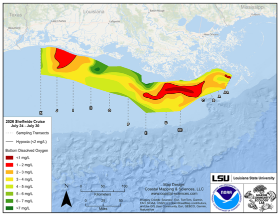
NOAA-supported scientists announced today that this year’s Gulf of America hypoxic zone is approximately 1,332 square miles, making it the second smallest zone on record in 40 years of measurement. Hypoxic areas, also called “dead zones,” are areas with little to no oxygen in the water, which can negatively impact fish, shellfish, corals and aquatic plants by making critical habitat unavailable to bottom species. Continue reading
Moderate Harmful Algal Bloom Predicted for Western Lake Erie in Summer 2026
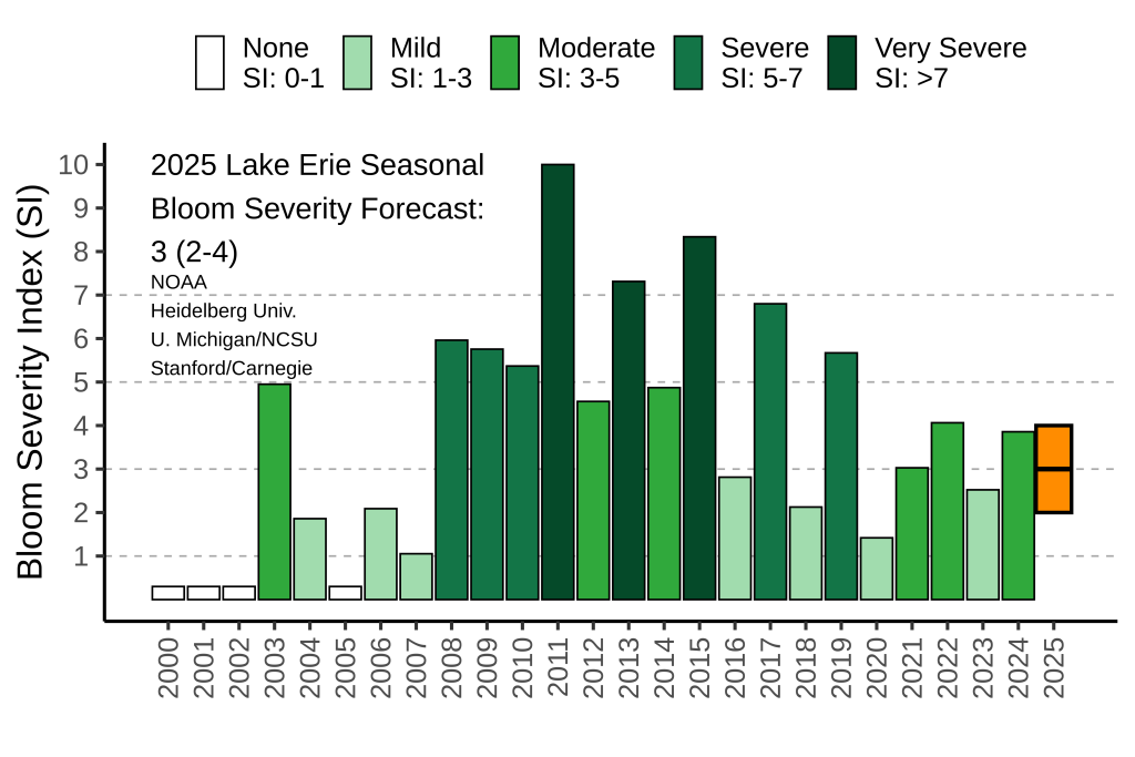
NOAA and its research partners are forecasting a moderate harmful algal bloom (HAB) in western Lake Erie this summer. This year’s bloom is expected to measure 3.5, with a potential range of 3–4.5 on the severity index. The HAB severity index is based on the bloom’s biomass (the amount of algae) during the peak 30 days of the bloom. Moderate blooms have an index of 3–5, while an index above 5 indicates more severe HABs. Continue reading
Transferring Harmful Algal Bloom Monitoring and Toxin Detection Capabilities to Arctic Tribes
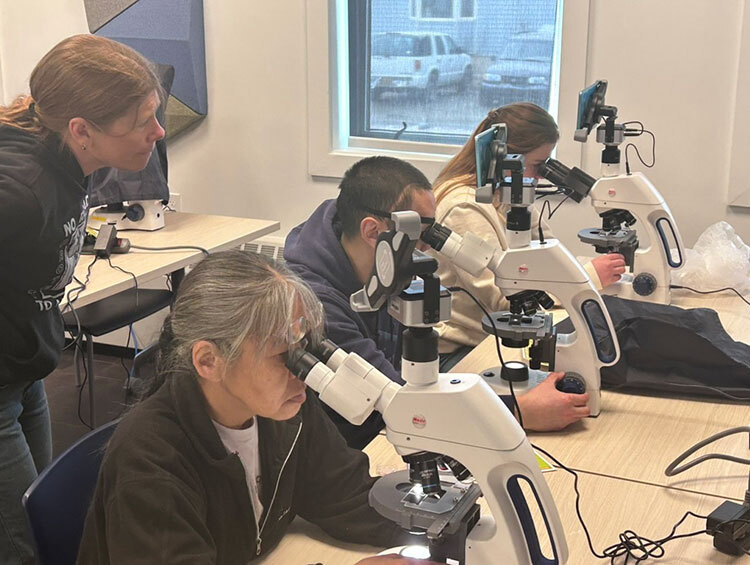
Marine resources have long been essential for the nutritional, cultural, and economic well-being of Alaska’s coastal communities. NCCOS-funded studies have demonstrated that warming Arctic waters are exacerbating harmful algal blooms (HABs) and increasing the potential for exposure to their toxins, underscoring the need for ongoing and enhanced monitoring to protect marine resources and public health. NCCOS scientists recently traveled to Nome, Alaska, to conduct specialized training workshops to transfer critical methodologies for monitoring HABs to the Nome Eskimo Community (NEC). Continue reading
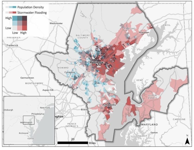
New Community Risk Assessment of Flooding and Heat Hazards Available for Baltimore
Chesapeake communities are at a heightened and increasing risk for flooding and coastal hazards. Impacts from these hazards are unevenly distributed across the country due to differences in topography, risk profiles, and local influences. NCCOS and partners have published a report and story map for a new assessment highlighting where communities in the Baltimore metropolitan area are most at risk from flooding and urban heat. Findings from the study will allow communities to better assess and document their risks from environmental hazards. Continue reading
Increasing Oil Spill Response Understanding and Capacity
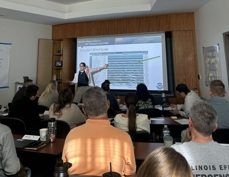
NOAA’s Office of Response and Restoration (OR&R) and National Centers for Coastal Ocean Science (NCCOS) cohosted a weeklong class for oil spill responders to increase their understanding of the science, effects, and risk-based decisions related to oil spills.
Continue reading
Aerial Drones Facilitate Mapping Alaska’s Kachemak Bay
The remote nature of Alaska’s Kachemak Bay combined with its intricate coastlines provide a challenging canvas to efficiently map. To overcome these obstacles, scientists stationed at the NCCOS Kasitsna Bay Laboratory in Seldovia, Alaska, are using uncrewed aerial systems (UAS) to map portions of the bay and offer critical information to resource managers. Continue reading
Researchers Find Beach Slope, Dune Elevation Key Factors that Control Erosion
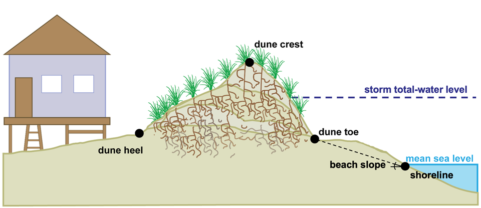
New research conducted at North Carolina’s Outer Banks shows that beach and dune profiles, along with total water level, are the primary factors controlling the amount of dune erosion following mild-to-moderate storms. Continue reading
NOAA Awards an Additional $7.1 million for Research in the Gulf
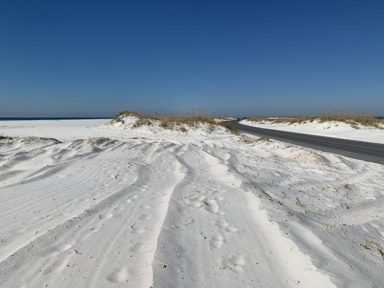
The NOAA RESTORE Science Program is awarding $7.1M in funding from the program’s 2025 funding competition focused on long-term trends in the Gulf of America ecosystem. Two projects will receive funding for five years to conduct long-term collaborative research that informs natural resource management along with the opportunity for five additional years of funding if they are high performing. These projects will track long-term trends in natural resources on Florida’s barrier islands and shallow and mesophotic coral communities off of Texas. Continue reading
|